About the Bays
The State of the Bays
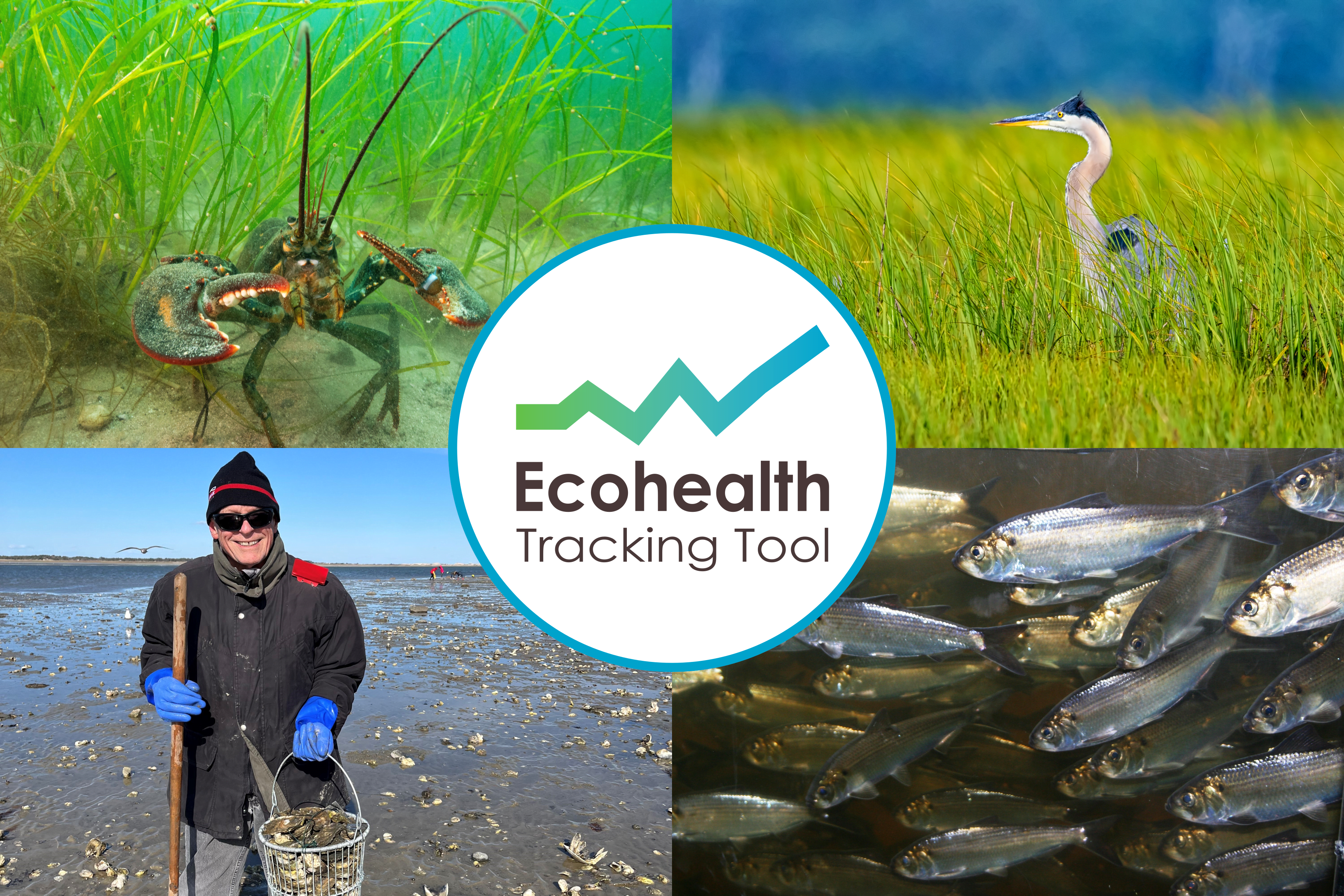
All National Estuary Programs are required under Section 320 of the Clean Water Act to provide regular reporting on conditions and trends in their respective study areas. MassBays has developed an online Ecohealth Tracking Tool to present information about the Bays using the most recent, quality-assured data available.
The ETT includes historic and up-to-date maps of the location and extent of salt marshes, eelgrass meadows, tidal flats, and diadromous fish runs in the Bays, compared to MassBays’ goals for those habitats. In addition, water quality data are available from thousands of sampling stations, allowing users to find data (including bacteria, nutrients, temperature, and other parameters) from estuaries across the region. Water quality stations can be selected to view a time series of the data and to see if measurements are within healthy thresholds.
Additional Resources
MassBays’ study area is a complex of natural systems which are home to hundreds of breeding and migratory birds, marine mammals, and fish; serve as nurseries for culturally, recreationally, and commercially valuable fish and shellfish; and provide ecosystem services to millions of people, including an increasingly vital role in mitigating the impacts of long-term changes.
Characterizing conditions and trends across the region requires significant investment on the part of MassBays and our partners. The data resources below will be incorporated into the Ecohealth Tracking Tool once reviewed and formatted for inclusion.
Ecosystem Delineation and Assessment
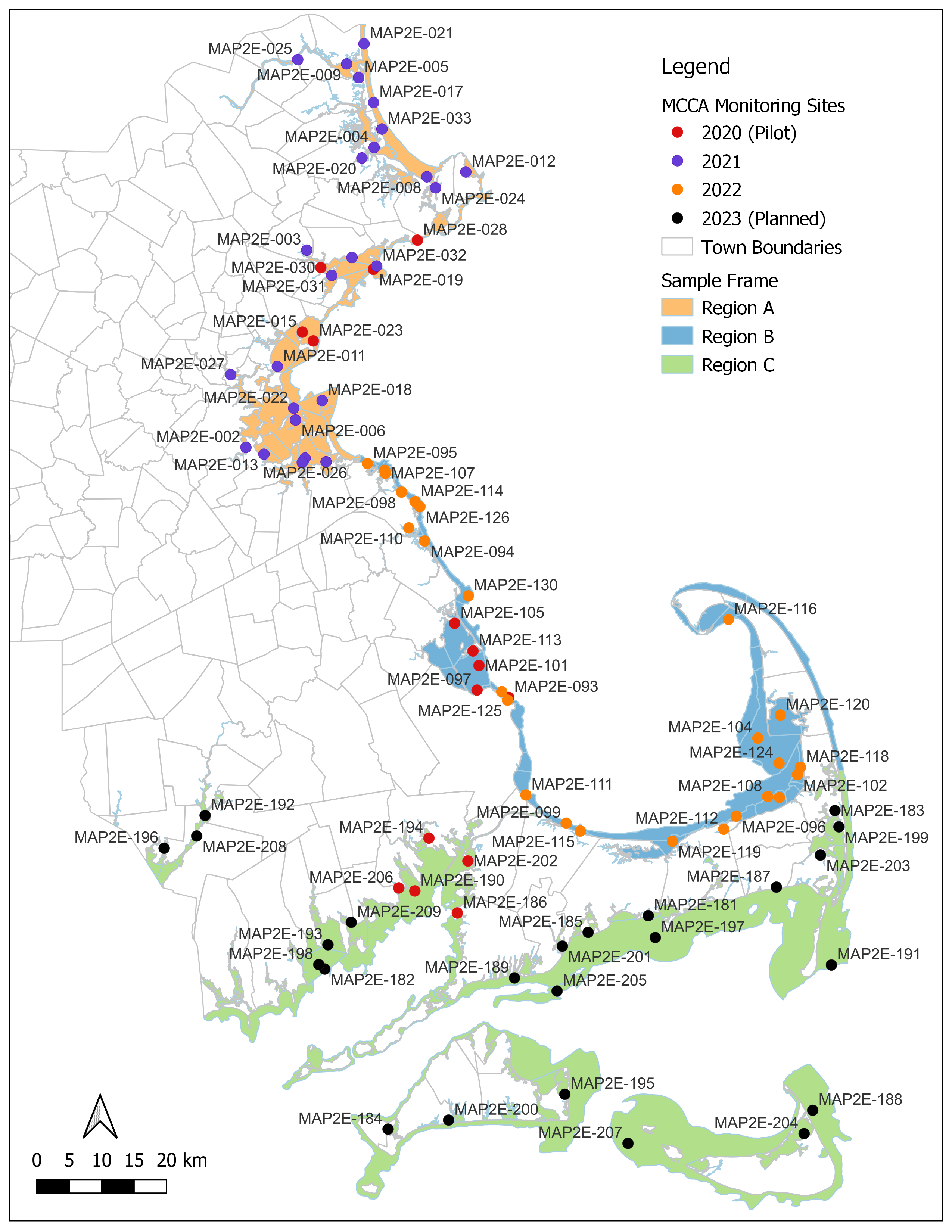
Massachusetts Coastal Condition Assessment
Between 2020 and 2023 the Massachusetts Department of Environmental Protection (MassDEP) and MassBays teamed up to conduct a statewide coastal condition assessment. The goal was to fulfil reporting mandates under Section 305(b) and Section 320 of the Clean Water Act.
With funding from MassDEP, over four sampling seasons, MassBays coordinated field work, including collection and analyses of water quality data, sediment characterization and toxicity, and assessment of benthic communities at 90 stations in Massachusetts waters.
A report of findings will be made available.
National Coastal Condition Assessment
Every 5 years the U.S. Environmental Protection Agency conducts a statistical survey of the condition of the waters along the entire U.S. coastline and the Great Lakes. MassBays uses the data collected and analyzed results of The National Coastal Condition Assessment as part of its state of the bays reporting. The most recent survey was conducted in 2020 and the next survey is expected to take place in 2025.
38 stations were sampled in 2020 for Massachusetts. Results of these surveys are available in comprehensive technical reports that provide analysis at the state level. Datasets are also available on the NCCA website.
Center for Coastal Studies Water Quality Monitoring Program
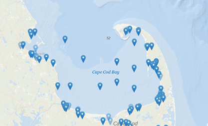
The Center for Coastal Studies (CCS) began monitoring coastal water quality in Cape Cod in 2006. Since then, this program has expanded to include over 100 coastal stations and 20 stations in the offshore waters of Cape Cod Bay and Nantucket Sound. This program is the longest-running and only bay-wide monitoring being conducted in Cape Cod Bay. These data can contribute to information on the state of the bays within the MassBays study area.
Boston Harbor and Massachusetts Bay Monitoring Program
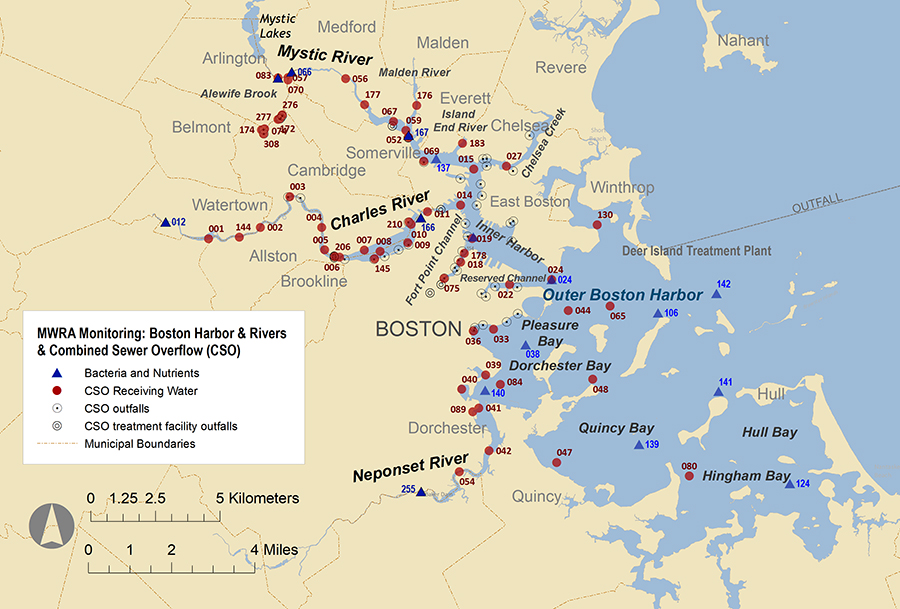
As part of the Boston Harbor cleanup, the sewage outfall was relocated from the harbor to Massachusetts Bay, 9 miles southeast off Deer Island where the Massachusetts Water Resources Authority's (MWRA) treatment plant is located. MWRA's discharge permit issued by U.S. EPA and the Massachusetts Environmental Protection Department requires extensive environmental monitoring to ensure that compliance with the federal Clean Water Act.
The survey includes measurements of nutrients, pathogens, solids, and the health of fish and shellfish in the water and sediments of Boston Harbor, and Massachusetts and Cape Cod Bays. The Cape Cod Bay station is monitored by the Center for Coastal Studies.
The map shows stations in Boston Harbor and up the Charles. Mystic and Neponset Rivers. Additional data are collected from offshore stations and buoys in Massachusetts Bay, at varying distances from the outfall.
Previous State of the Bays Reports
2022 Conditions in the Bays
2015 State of the Bays Symposium Proceedings
2010 State of the Bays Report